Benjamin Heffner
Connector Editor
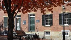
UMass Lowell got its first winter weather system of the season as Winter Storm Chan moved its way through the Northeast, delivering heavy snow threats from Pennsylvania to Maine.
“We’ve been talking about this in some of our weather classes since before Thanksgiving Break. As weather enthusiasts, we like to be very hyperfixated on these sorts of things, so we’re all very excited about having a snowstorm,” said Darius Daniels, president of the American Meteorological Society student chapter at UMass Lowell.
In Massachusetts, areas in Northern Worcester, Northern Middlesex, and Eastern Franklin counties were under a Winter Storm Warning, while areas in Central Middlesex and Western Essex counties, including the city of Lowell, were under a Winter Weather Advisory.
While an exact snowfall total was not measured by the National Weather Service, it is estimated that Lowell received 1.6 to 2.2 inches of snow.
Several school districts across the state closed or released students early, including UMass Lowell, which closed at 11:00 a.m.
In addition, a parking ban was enacted from 11:30 a.m Tuesday to 7:30 a.m. Wednesday.
Daniels said that given Lowell’s unique position on the snow/rain line, he watches for what the precipitation types will look like as well as the general timing.
He said, “[The storm] was more impactful for the afternoon, so I’m glad the university made the right call to accommodate commuter students so they could get home safely.”
The 2025-2026 winter season, which officially starts with the winter solstice on Sunday, Dec. 21, comes after last year’s season brought persistent rounds of freezing temperatures and impactful weather events, including a powerful and historic blizzard that struck areas of the Gulf Coast that rarely receive any precipitation.
Dr. Jeffrey Basara, chair of the environmental, earth, and atmospheric sciences department, said that this storm was typical in terms of its overall evolution and development.
He added, “It’s what we would call a coastal storm that kind of reached that nor’easter-type standpoint and was rapidly developing and evolving, so this is what we would expect this time of year.”
Daniels said that while this year’s winter season will ultimately have a little bit more snowfall, it will mostly be centered around December and January.
He added, “We do know that as the planet is warming and winters in the Northeast are shortening, they’re becoming warmer and wetter as opposed to colder and snowier, which would make sense because even just a couple of degrees difference can make all of the difference in whether we see more rain or snow, especially in Lowell.”
It has been nearly four years since a blizzard hit Massachusetts, in which Lowell got hit with about a foot and a half of snow.
When asked about the possibility for a blizzard this season, Daniels said, “I wouldn’t be surprised if we did see a blockbuster storm system within the next couple of months, but we’ll have to wait and see as conditions develop a little later on.”
Basara said that any major storm system could be actively classified as a blizzard by the National Weather Service (NWS), given the one in January 2024 that dumped over a foot and a half of snow.
He added, “It’s pretty possible to have one of those types of events that I would say in any given winter, so we’re always going to be potentially on the receiving end of a significant snowstorm.”